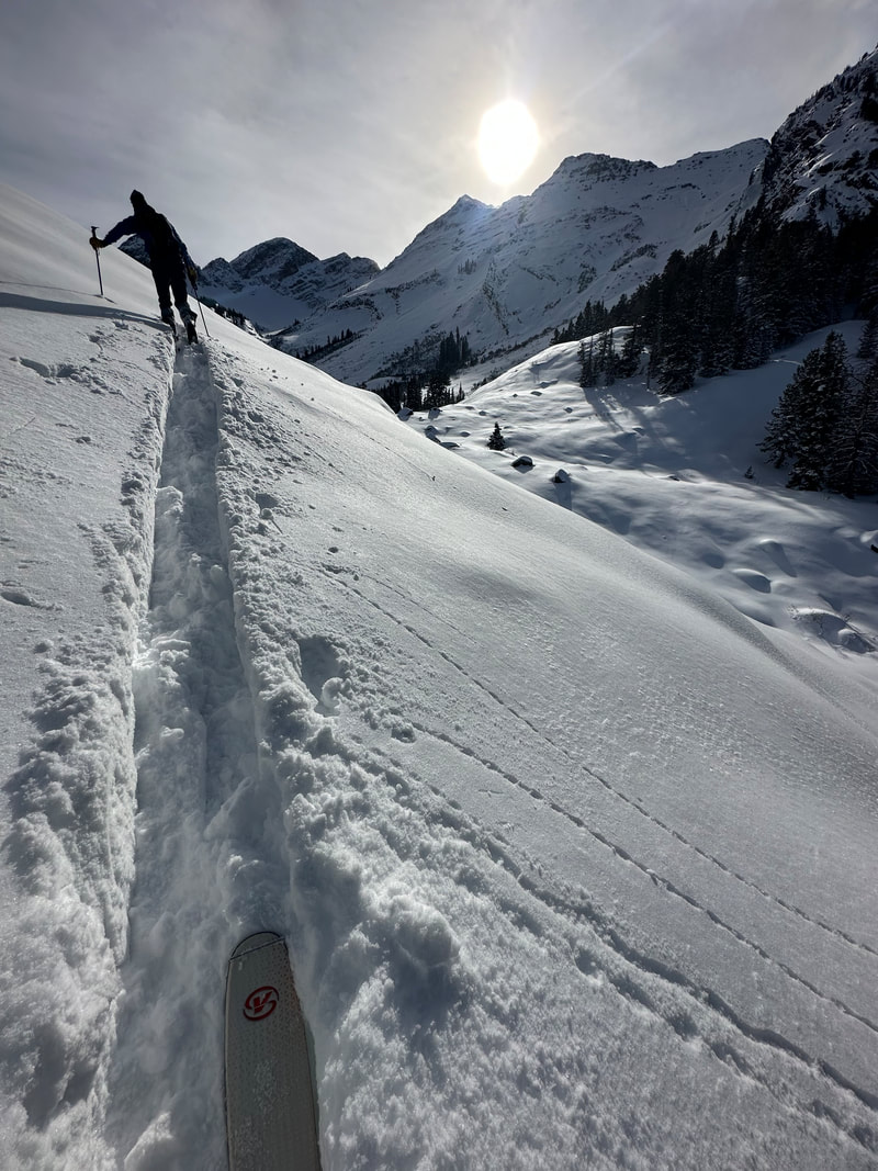
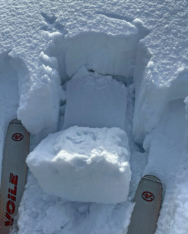
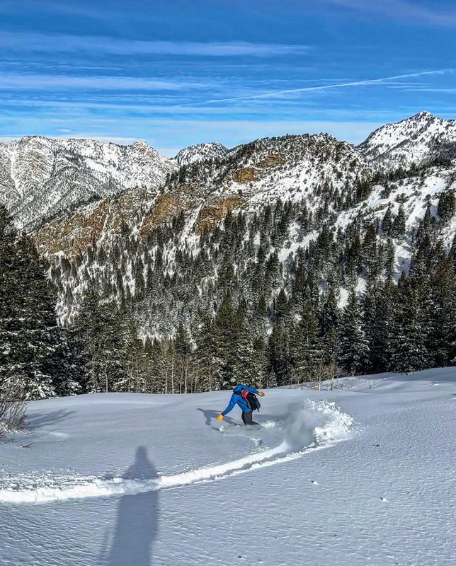
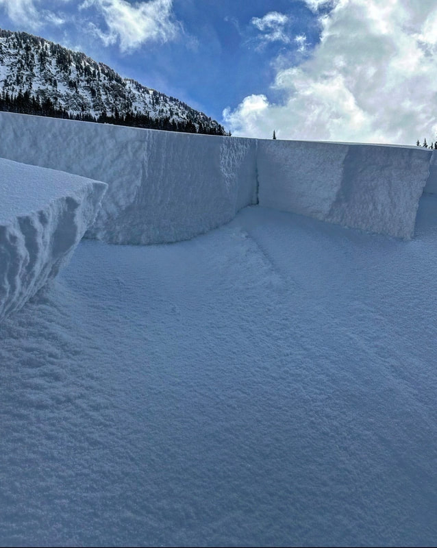
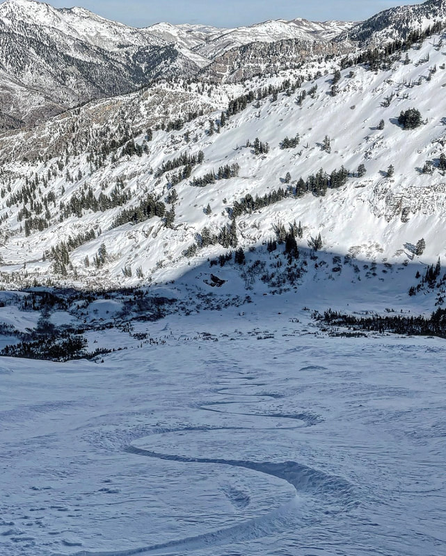
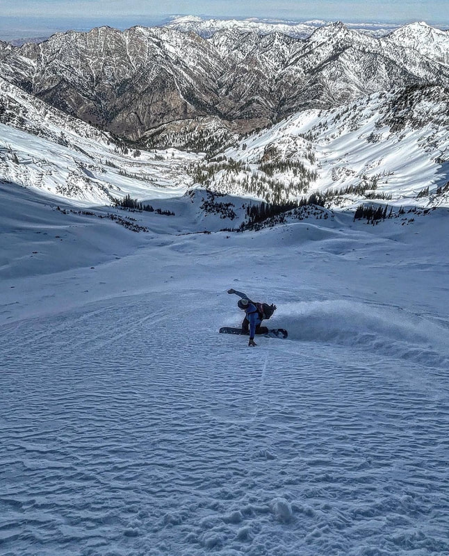
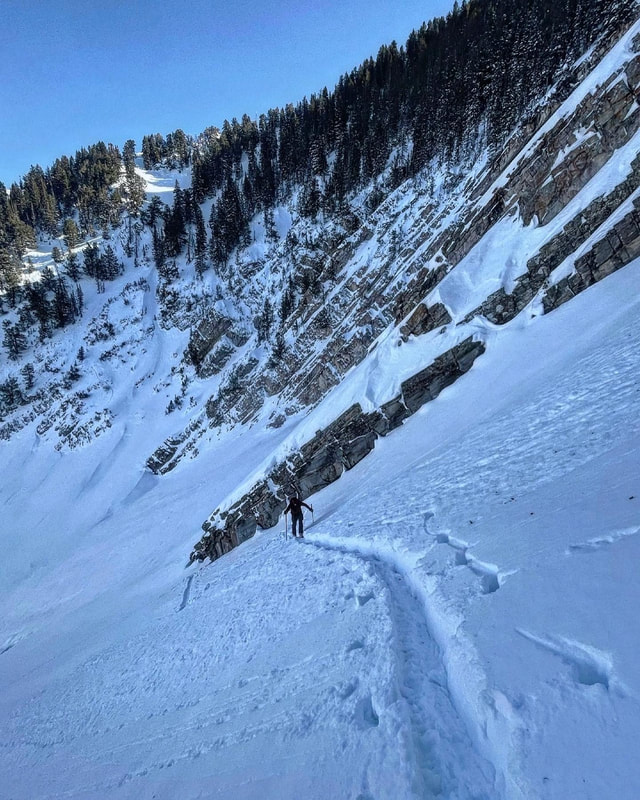
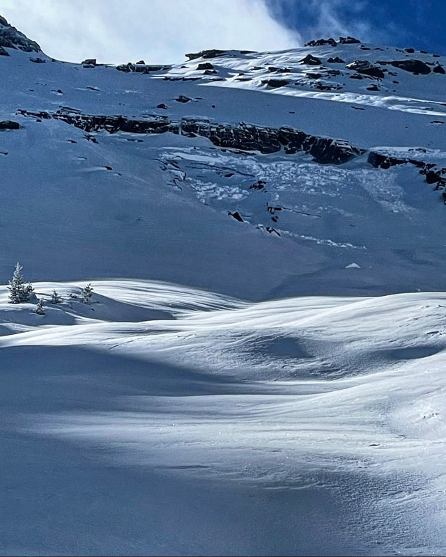
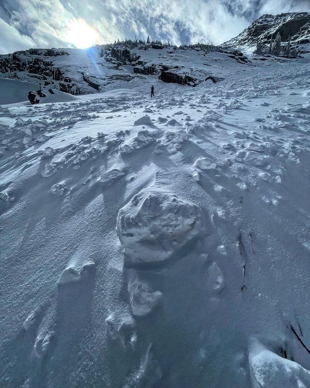
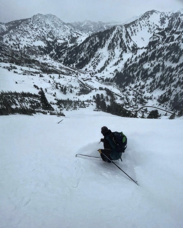
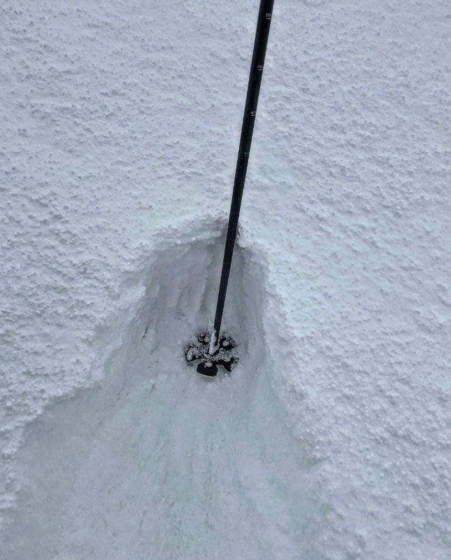
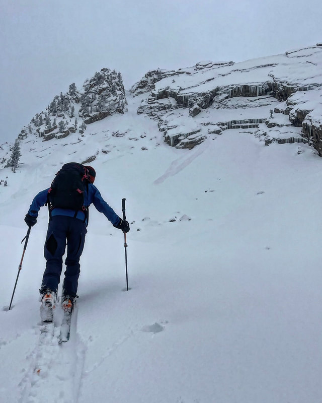
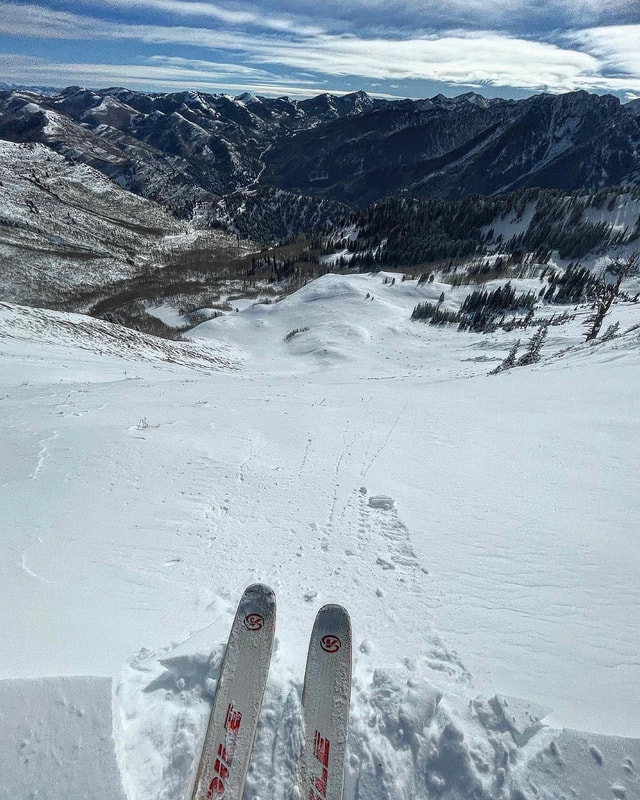
Broads fork11/30/2022 Decided today was a good day to go see what happened on the big lines in Broads Fork. As usual I was gambling that there was major avalanche activity on Bonkers and the Diving Board that would allow safe skiing. When we arrived at the overlook it was obvious that the gamble of the long walk in didn’t really pay off today. There was no avalanche activity noted anywhere in the upper drainage, only high winds, slabby looking snow on the E/NE facing and wind scoured slopes on the W facing. We had already made the decision that if there was no obvious avalanches allowing a safe ascent we would not venture into the upper drainage. The combination of intense wind loading on the SLC Twins and slabby snow on the aprons made the decision to ski something lower in the drainage easy. The hazard was even noted below 8000ft on a low angle N facing slope with collapsing and cracking of the entire glade. Dug a quick pit to look at the pack, there was close to 3 feet of snow with a hard frozen layer at the ground then the nasty layer of completely faceted snow about 8 inches in depth, with the new 16 inches of storm snow on top of that. Once the column was isolated there was an easy, clean sheer on top of the facets, leaving the PWL intact. The storm snow in the pit was still light density, not slabbed up or connected but the shear was easy to get. I would assume if you find an area with a connected slab sitting on this weak layer it’s probably going to pop out with lots of energy and be well connected. I’m hoping Fridays storm comes in warm and wet with a bunch of wind, cause at this point in time a big clean out/avalanche cycle is our best bet for future stability.
0 Comments
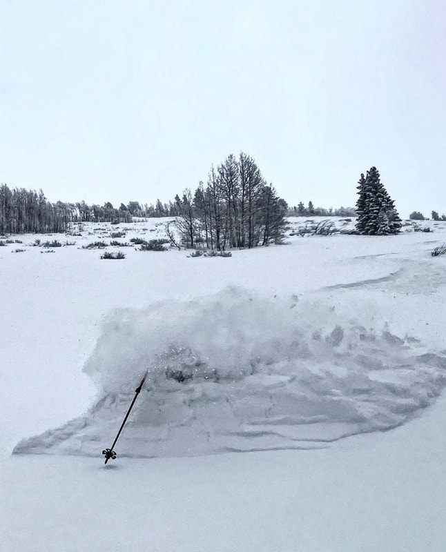
Cardiff fork11/29/2022
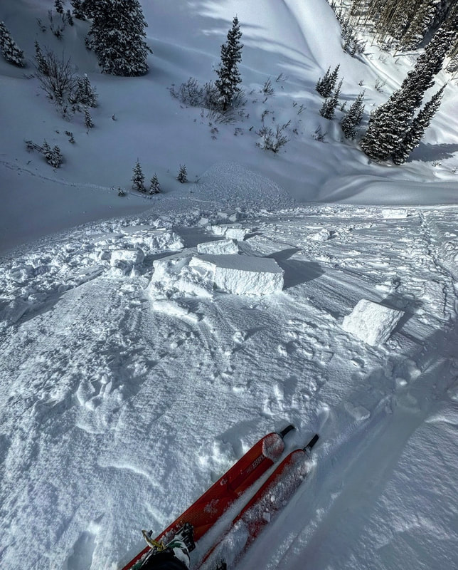
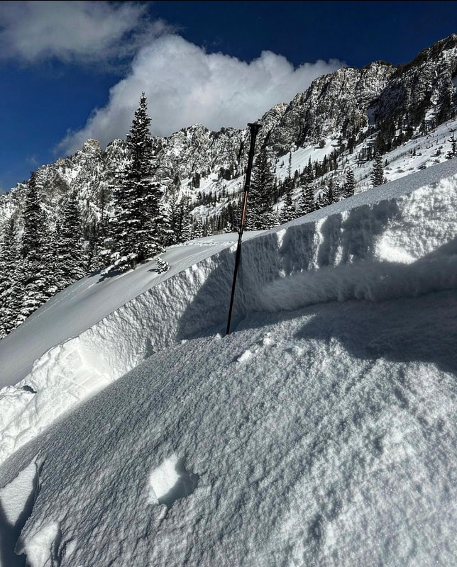
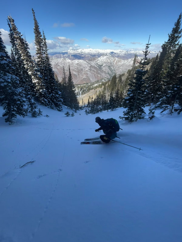
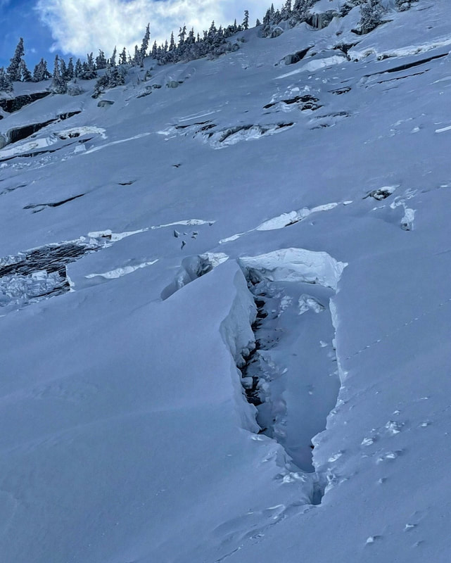
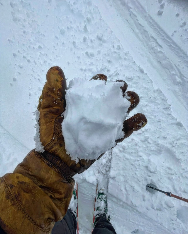
Headed up Cardiff Fork from BCC today. It was more like a field day than a ski day. There was probably a foot of new light density snow at the trailhead increasing to around 18 inches at 9600ft. I knew we had the setup for avalanches but wasn’t seeing much of a cohesive slab at first. By the time we got above 8700ft the snow was a bit denser and settling out. Went to my favorite test hill and remotely triggered an avalanche from 40ft away. The slide was 17 inches deep, 160ft wide on a NW facing slope, 45degress, and ran on the facets that have formed over the last few weeks. The discouraging thing is the slide did not clean out any of the facets, only the new snow slid and left the now PWL intact. There was no evidence of a widespread avalanche cycle in upper Cardiac. It looked like there were multiple storm snow slides on the ridge during the storm but not any real crowns and the bowl looked like sluffing only. The rock slabs above Ivory Flakes looked to have sluffed or slid during the storm but still no visible large crowns and zero had moved on all the W facing including Holy Toledo. The weak layer has been preserved and buried and I don’t trust it. The SE has a thin melt freeze crust capping the facets but in my book that makes a recipe for larger and more connected slides. That being said, I'm not talking about the South on skier compacted terrain like the Emma’s across from Alta. I'm talking about the SE that is more pristine. I will be holding my cards tight and with another large storm predicted on Friday all bets are off. Hopefully the next storm will contain more water weight and wind cause a big clean out is what we really need right now.
November 21st, 202211/21/2022
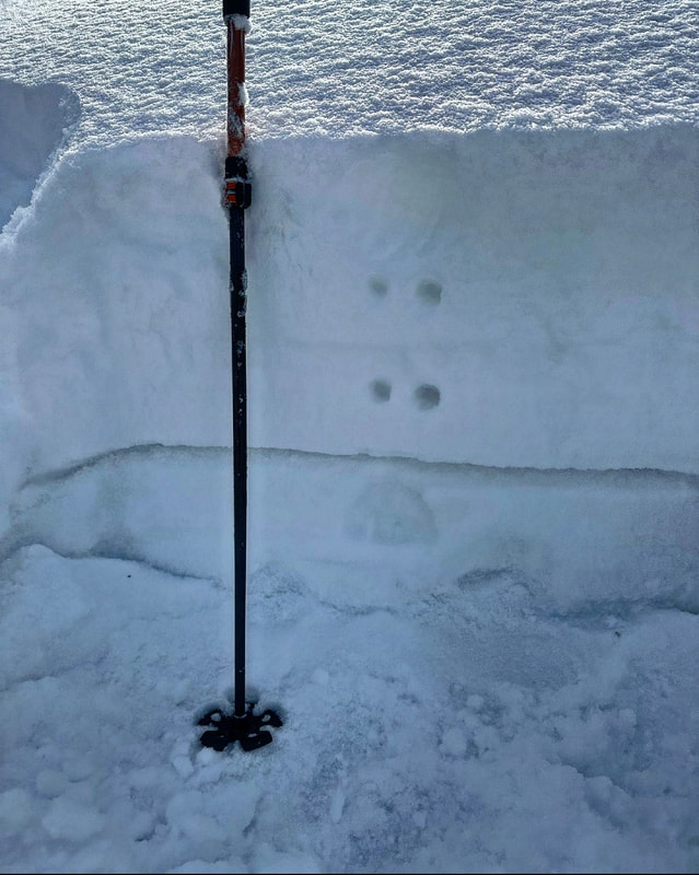
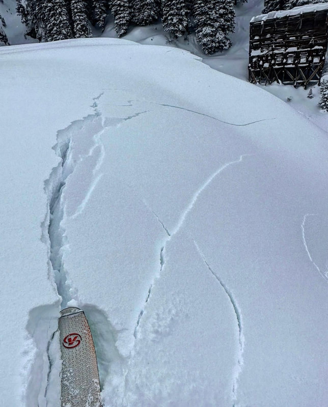
Today we went to have a look at No Name Bowl on the PC Ridgeline. This is a mid elevation NE facing, protected bowl at around 9400ft. I wanted to see how advanced the faceting has become in sheltered mid elevation N facing terrain and just like I expected the facet machine has been on full blast for the past week with cold clear nights and days. The most disconcerting part is that it is no longer just the surface or the top 4 inches that are faceted, it’s the whole snowpack. From the starting zone down to the dirt. Long running sluffs could be initiated easily in steep terrain and the sluffs would gouge down into the weak snowpack as the ran. It’s not like this everywhere. I was in the alpine on Saturday and the faceting was not near as advanced because of the wind damage that occurred last week. That being said the alpine has its own not so friendly set up, with a thin layer of facets on top of the windboard and facets forming below the wind crust. In theory this setup could hold more weight and produce larger avalanches when a load is placed on top. Nothing really going on right now except the weakening of the snowpack but when we do get a real storm all bets will be off.
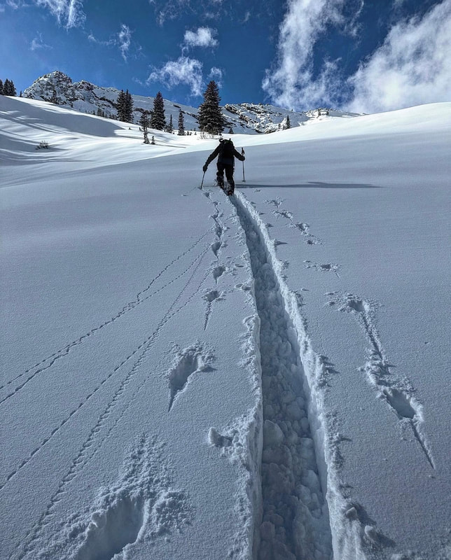
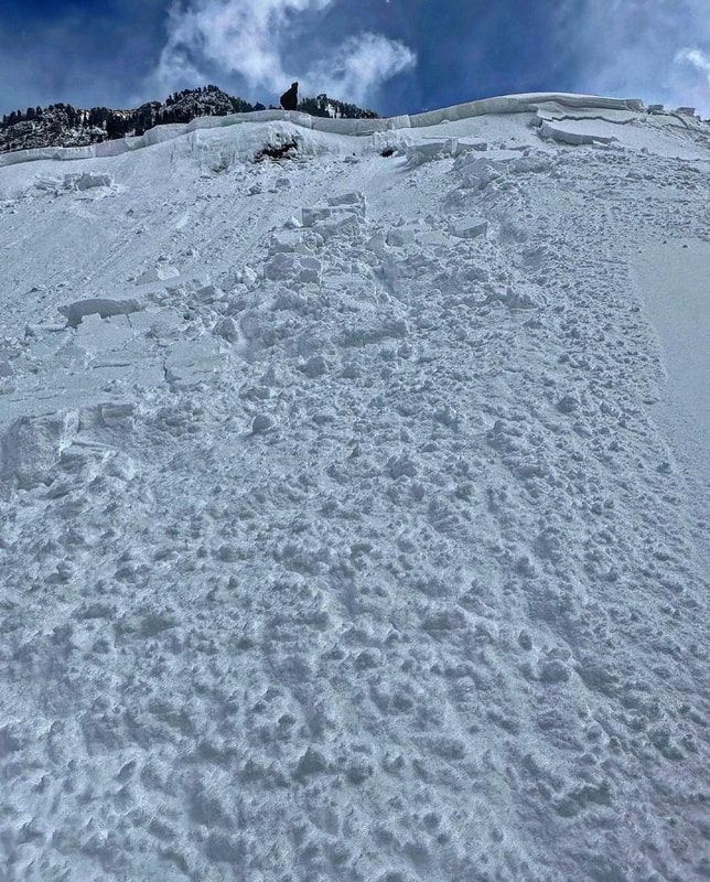
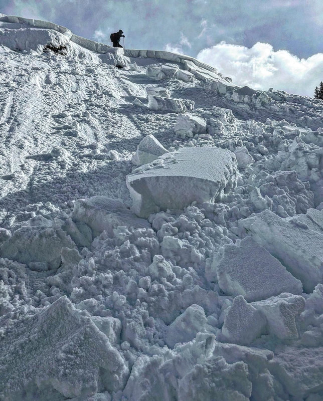
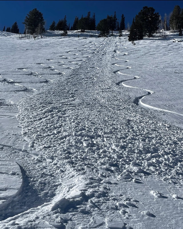
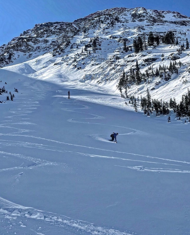
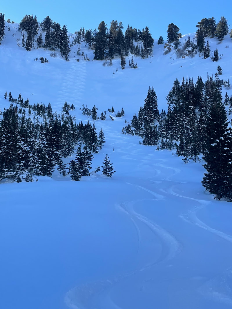
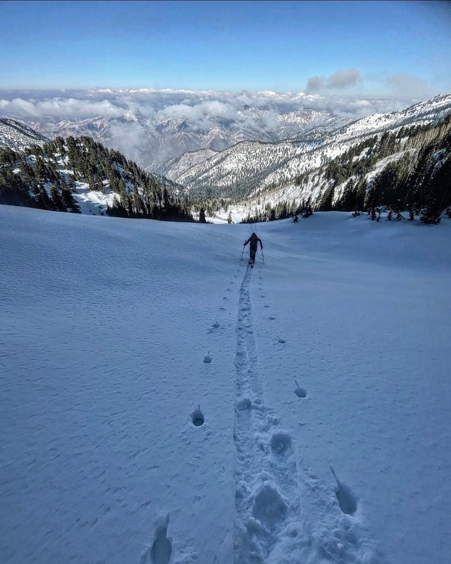
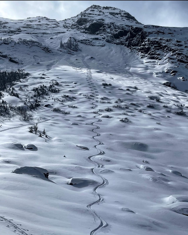
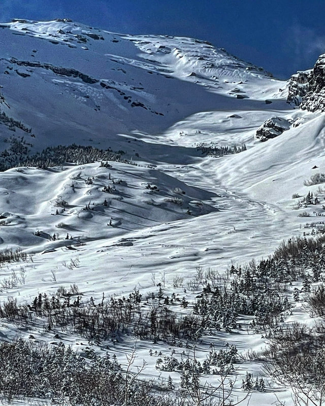
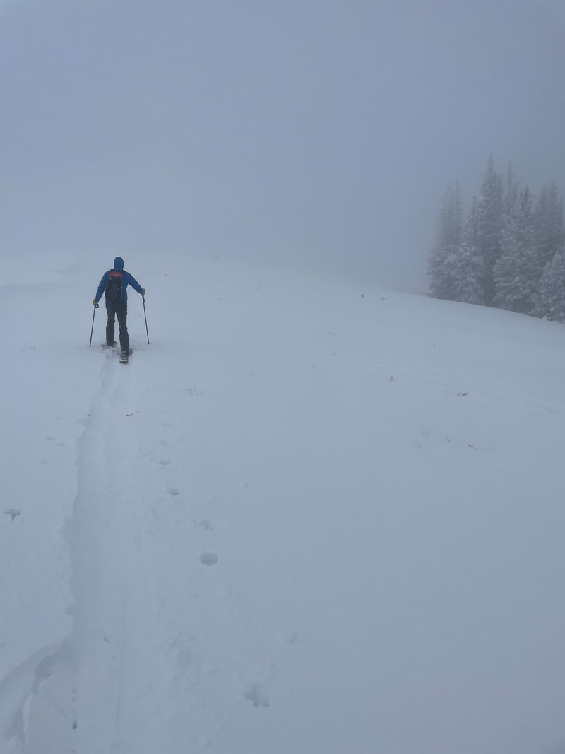
Broads Fork11/17/2022 Today we made the long haul up to the apron under Dromedary and Sunrise Peak in Broads Fork. There’s literally no snow at the trail head so you end up walking the first 2 miles and 1200 ft to the bridge before there’s enough snow to skin on. The upper drainage had been a bit windjacked last week but the cold clear nights have even faceted out the windboard in the alpine making it more friendly. Down low in protected terrain the surface is a mixture of facets and surface hoar. Went to the end of the drainage this time and got the full scope of the avalanches from the last cycle. The E Twin had a large avalanche that ran to the valley floor and you can seen crowns strewn all over the upper shoulder and the NE face. The E face had also cleaned out. All the N facing upper bowls had run. Basically all the surface snow is getting weak and with a slick base underlying it all bets are off when we receive a decent load of snow.. Bowman Fork11/17/2022 On 11/15 we went up Bowman Fork to see the coverage in the Millcreek area. Not much snow at the trailhead, increasing to 3 ft at 10,000ft. We ended up skiing Yellowjacket N facing, Depth Hoar Bowl NE facing and Bonus Bowl NE facing at 9000ft. All the snow encountered was faceted on the surface which made for slippery travel. The lower elevation Bonus Bowl was covered in surface hoar the size of cornflakes and the exit in the gully had even larger surface hoar. Not much hazard now but the surface sluffs are getting larger in steeper terrain and the weak surface snow will be problematic with a load of snow. We exited out on the upper Millcreek road which has just enough snow to ski to the gate. Porter Fork11/13/2022 Today we headed up into Millcreek for the first time this season. Travel was up Porter Fork to Piece of Pie on the backside of Mt Raymond, NE facing. Last weeks storm snow has settled out with boot deep penetration and dry recrystallized snow on the surface. There’s a fairly stout rain crust up to 8500 ft and above that a dense stable snowpack right side up. The snow on the surface is faceting out and recrystallizing. The long running sluffs in steep terrain are the norm in these wind protected locations. Piece of Pie avalanched during the storm and ran about half track. The snow on the N facing remains dry but anything with S in it has a ugly melt-freeze crust. We were finding 3 to 4 feet in the upper drainage dropping to a couple feet at 8500. The surface will continue to facet out on the shady protected N and will most likely be an issue with the next storm. Broads Fork11/10/2022
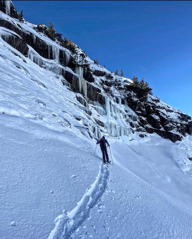
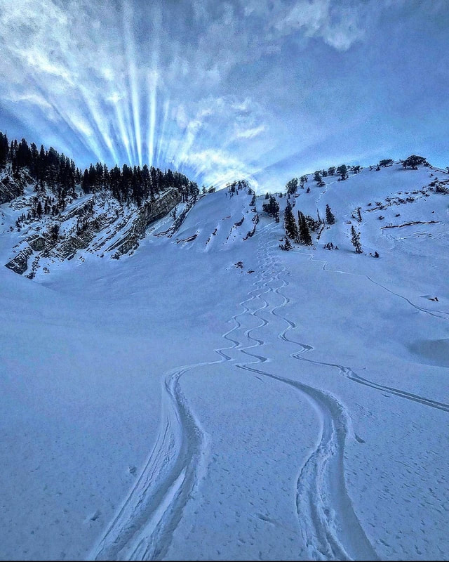
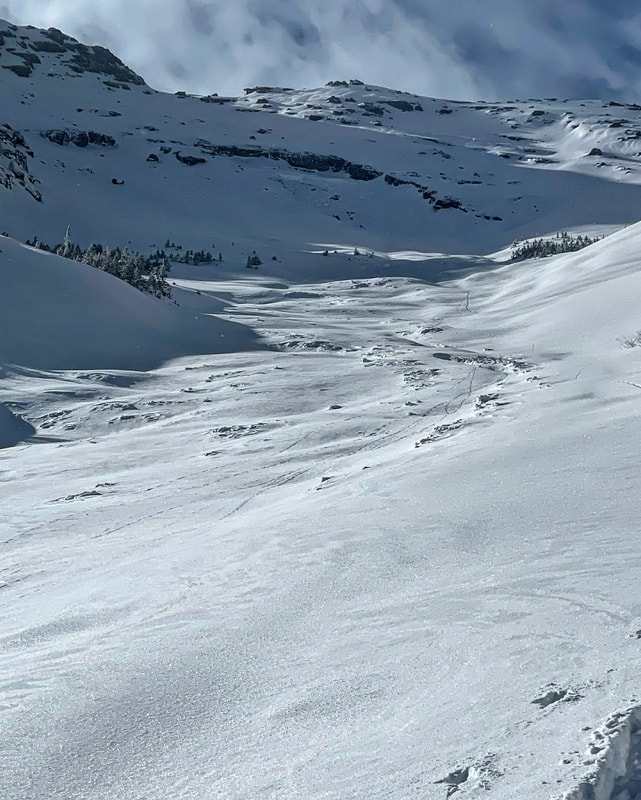
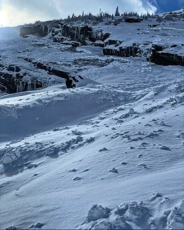
Travel today was up Broads Fork from the S turns in BCC. Started walking in 2 inches of light density on dirt and rock. Once we got over the bridge there was a little old crusted snow underneath. After that there was a couple feet at 7500ft with a rain crust that was present up to almost 8500ft. Once we got up in the upper drainage it was obvious that the NE facing went through a large avalanche cycle. In Bonkers the whole upper bowl pulled out and stepped down under the upper cliff band NE facing to the ground. The slide ran at least 1500ft vertical and left a large debris pile in the apron, close to full track but not quite. There was also a couple Glide avalanches that took place in the rockslabs above the Diving Board, cleaning the polished slabs of snow and ice, leaving large chunks of Ice scattered on the main slope below. The Blue Ice avalanched to the valley bottom as well, leaving large debris piles at the bottom. Finally, the E Twin shoulder avalanched and filled in the Diving Board below it. All these slides seemed to happen during the storm or right after although the glide avalanches probably happened Tuesday. The depth of the snow at 9000ft is almost 4 feet.The skiing was really good but the price of admission is really high involving a lot of walking without skis on and walking down from the bridge. Awesome storm for our base, things are filling in nicely and we will have a solid base if we can keep adding to it.
Cardiff bowl11/8/2022
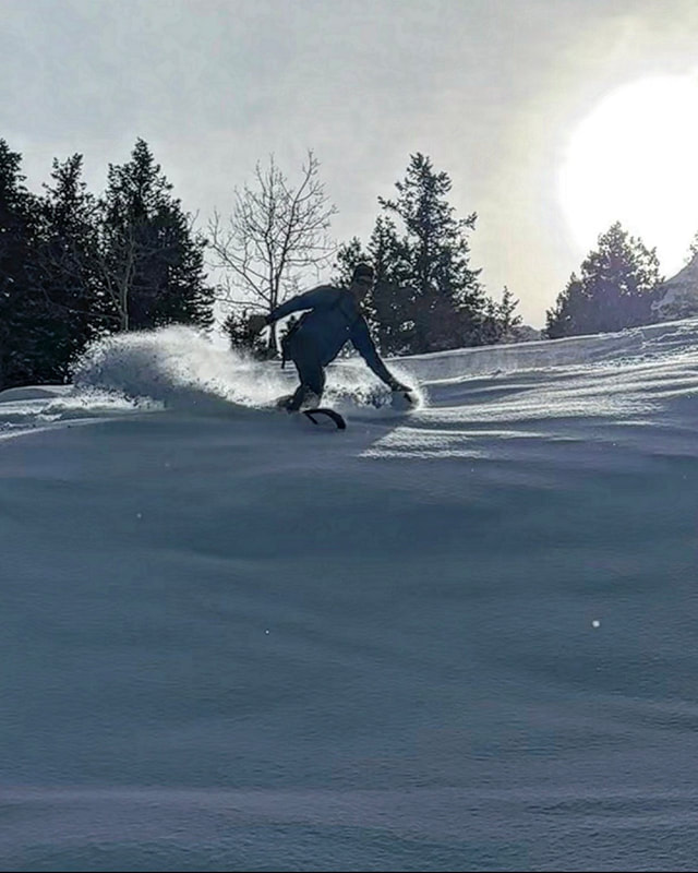
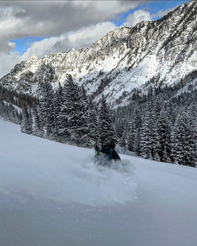
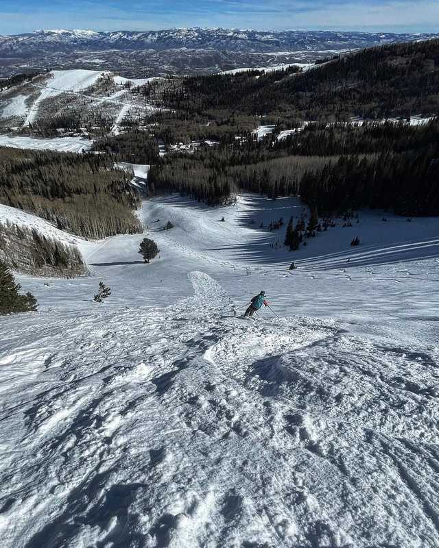
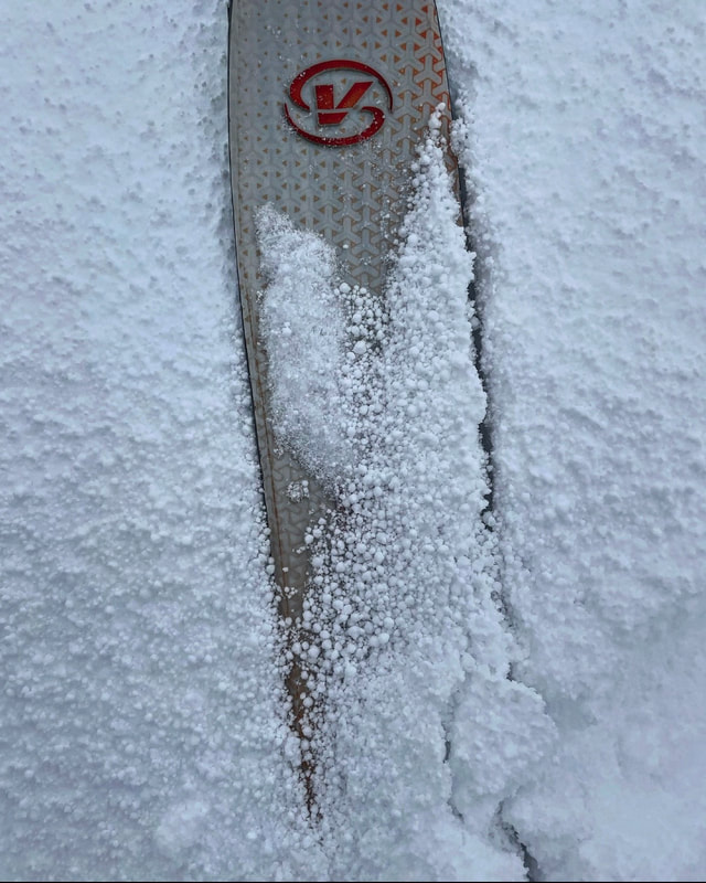
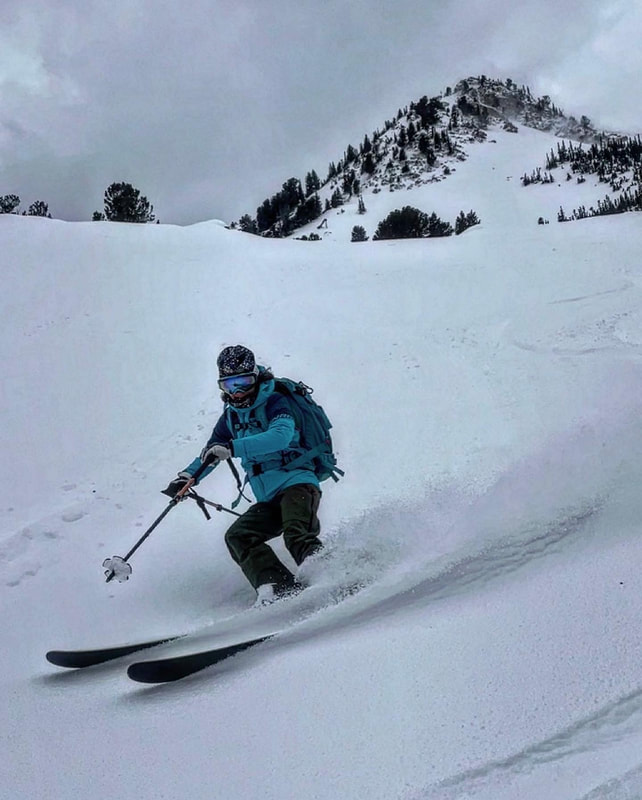
Decide it would be a good day to ski across the street from Alta today, mainly Cardiff Bowl and East Hellgate. The storm had dropped 5 inches of graupel by the time we arrived and the strong winds yesterday had smoothed out the old surface so we knew the S facing would be good. It was even better than expected with creamy turns and no bottom feeding. There were a few exposed spots on SE facing terrain features that were scoured down to the old snow surface but the coverage had improved dramatically with the graupel filling in all the rocks and other terrain features all the way down to the road. The graupel was loose and non cohesive and not forming any sort of slab. The wind did continue to blow in the strong category all day, and around 3pm the graupel turned to snowfall and intensified. Hazard tomorrow depends on how much snow falls on top of the graupel and how much of a cohesive slab is on it. Todays graupel bonded about as well as graupel does to the old surface. If we get a decent load tonight I’d be wary of steep exposed slopes until they are proved innocent.
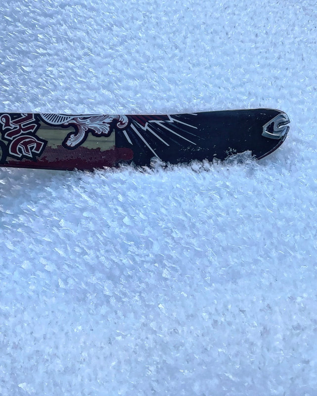
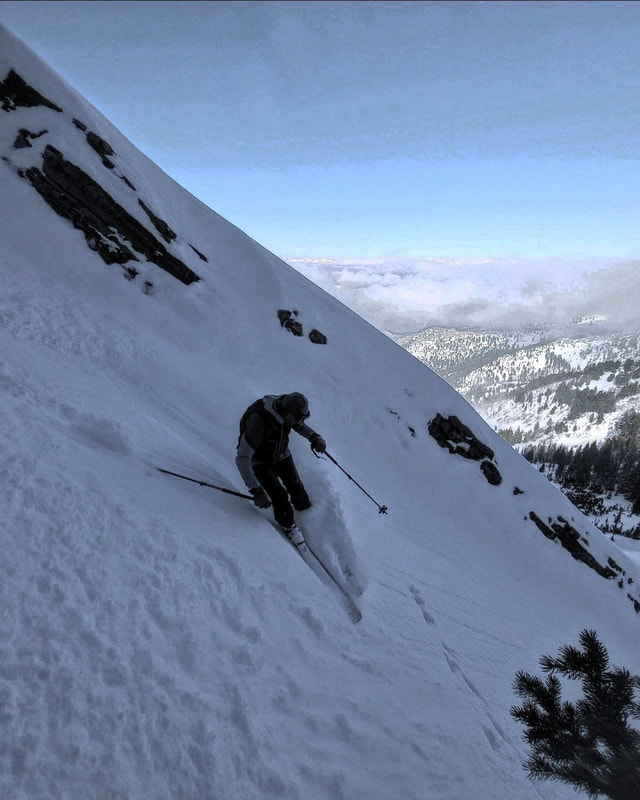
Cardiff Fork11/6/2022 Todays travel was up Cardiff from BCC, to Ivory Flakes, which is E facing and just under 10,000ft in elevation. There was 2 inches new damp snow at 7’200 ft and maybe 5 around 10,000. The snow up high was dense and surfy keeping you off the rocks for the most part but the surface was getting damp later in the day under 9,000ft due to warm temperatures and a bit of mist or light rain. The snow pack in general has settled out to a right side up compressed, damp at the ground state, which in my book is a really good start. The storm only produced 8 inches at the most and not the 16~20 predicted. The only instabilities noted were dry snow sluffs on Cardiac Ridge and below the Ivory Rock Slabs. You could make a snowball from the surface snow at 9,500ft and it seemed like the light density from Wednesday’s storm has been compacted in the terrain covered and is not going to be a factor in stability, especially after a very warm day tomorrow before the next storm. So far so good, praying we get the 2 feet predicted for midweek. Photo 1 is the snow surface at 9,500ft later in the day, photo 2 is a loose dry sluff that happened during the storm South Monitor and Raymond11/4/2022 This ob is from the last two days, Yesterday was in S Monitor and USA Bowl, and today on the SE face of Mt Raymond. Yesterday was cloudy and windy with light snowfall. Headed over to S Monitor Bowl via USA bowl, the wind was cranking on the ridgeline from the N-NE forming cornices in the reverse direction than they are usually formed in. The visibility was poor only providing a view of the top of the slope. What we could see lead us to decide to skip it. Never been a fan of diving into a steep bowl with wind affect and zero visibility. USA Bowl was not winded and had about a foot of light density snow from the storm. Found out today from some friends that it was windjacked top to bottom. Today we headed up Butler Fork to Mt Raymond. Not much snow at the trailhead but there was a solid 2 feet on the SE face of Raymond. The snow under the new 8 inches of light density was a slick and supportable crust which kept you off the rocks and dirt for the most part. There was also surface hoar forming in the wind protected areas. If this storm plays out like they say, warm, windy and with dense snow I think we might have some avalanches on all aspects. Any slope with a slick crust underlying it and with light density on top is a good set up for poor bonding, meaning the thicker slab on top can collapse on the light density layer underneath then step down to the old slick crust. These would most likely be slopes on the S end of the compass or at lower elevations. On the N end of the compass there is weak light density snow that might not hold the weight of a dense slab as well. Will just have to wait and see what the weather does, but I’ll probably dial it way back for a bit if the weather does play out. If you are enjoying the observations, please consider donating on VenmoMark-White-240 
Archives
January 2024
Categories |

 RSS Feed
