Butler Avy path1/19/2024
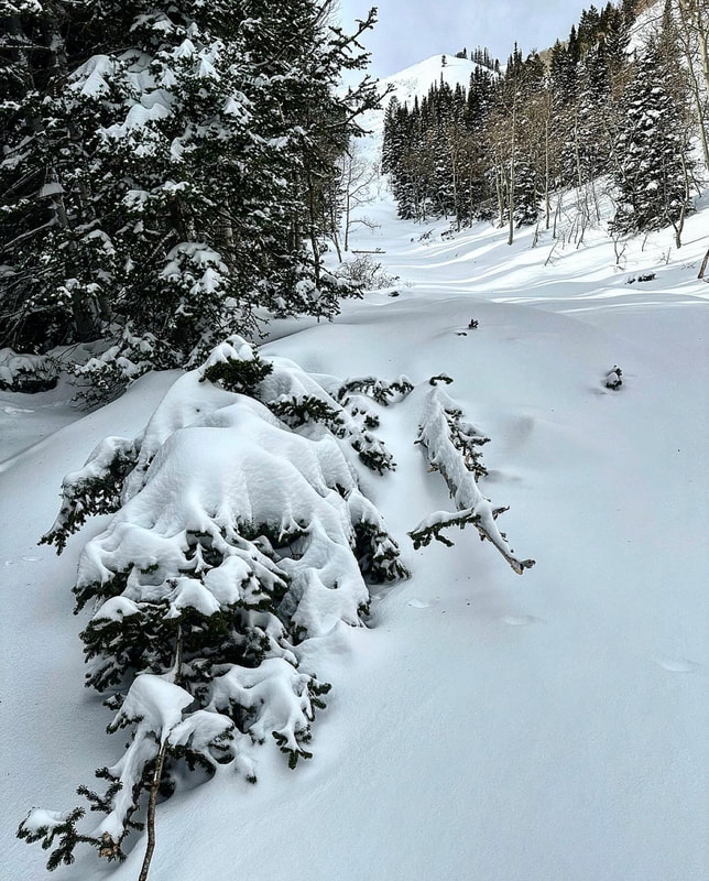
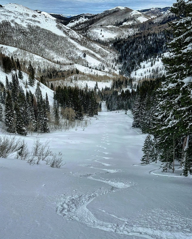
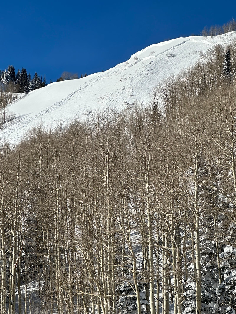
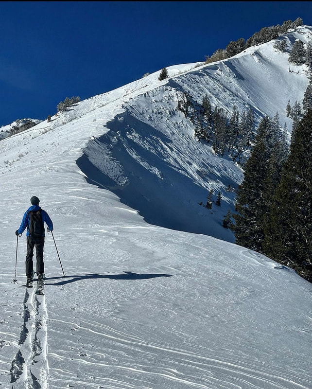
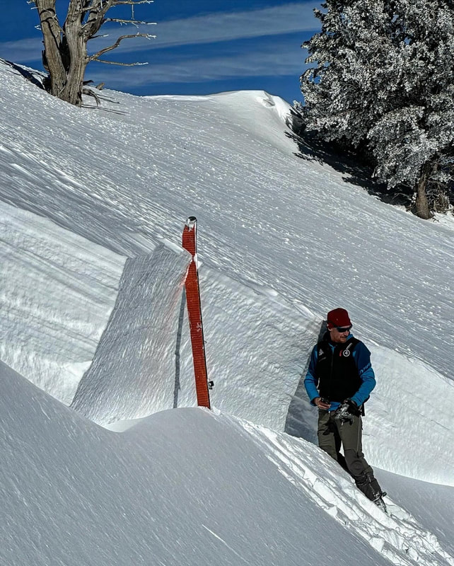
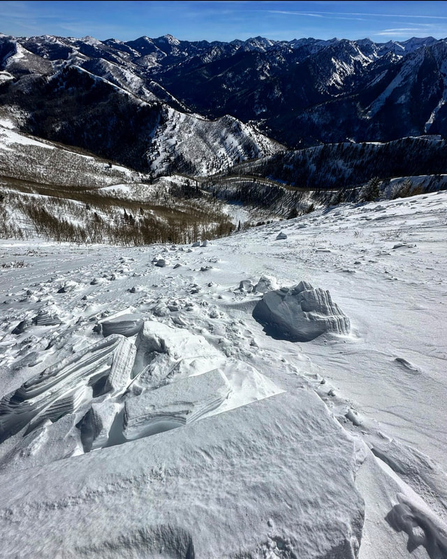
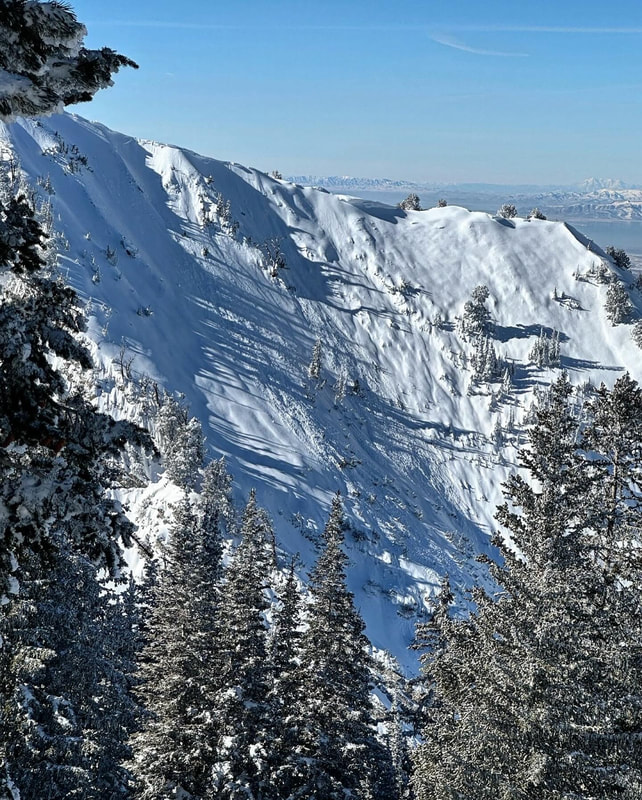
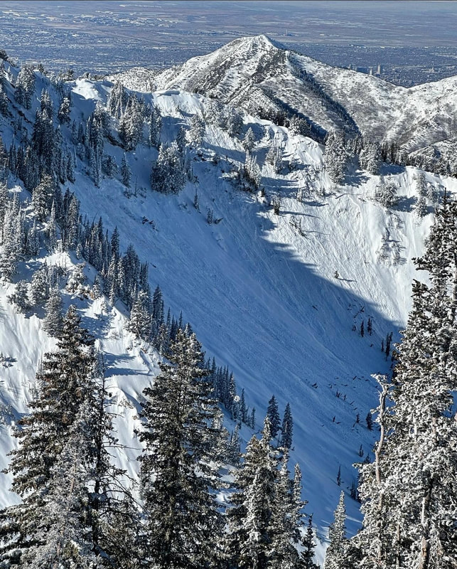
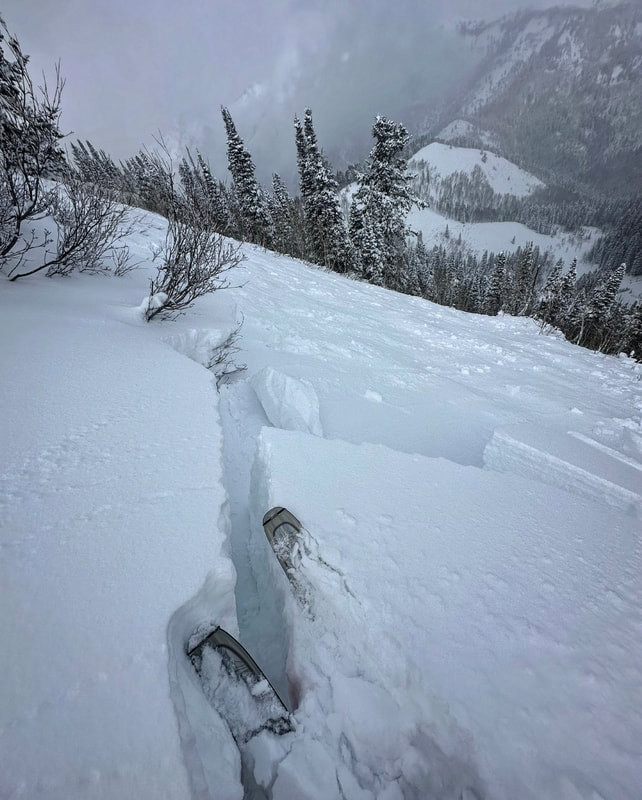
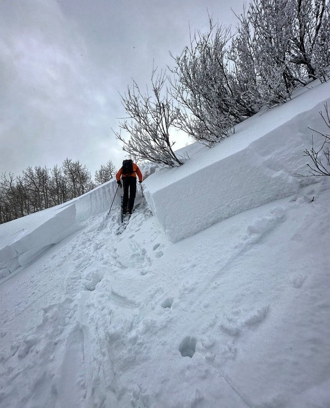
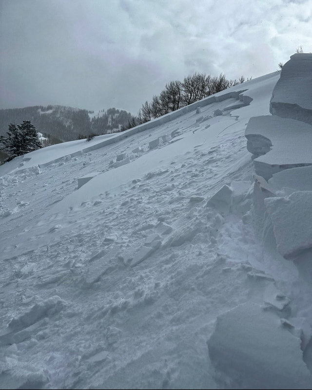
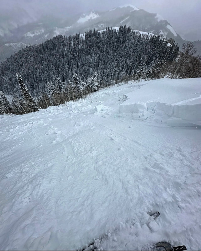
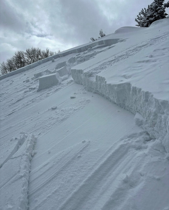
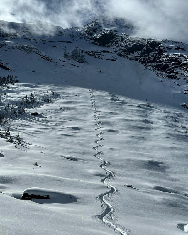
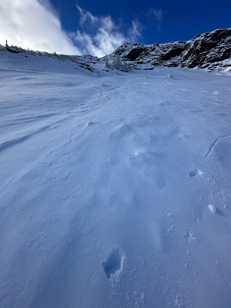
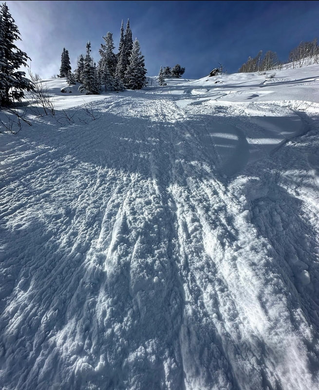
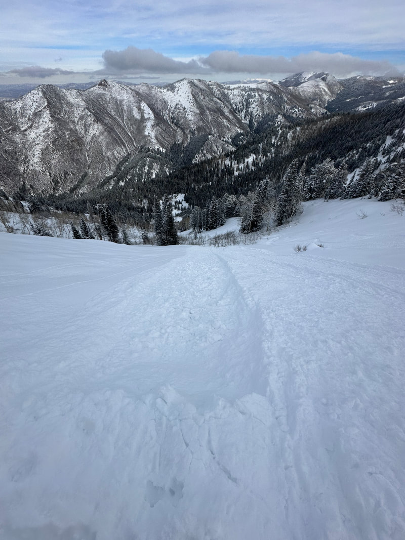
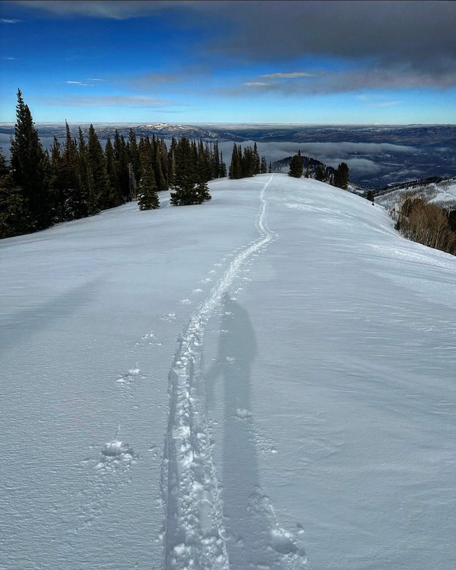
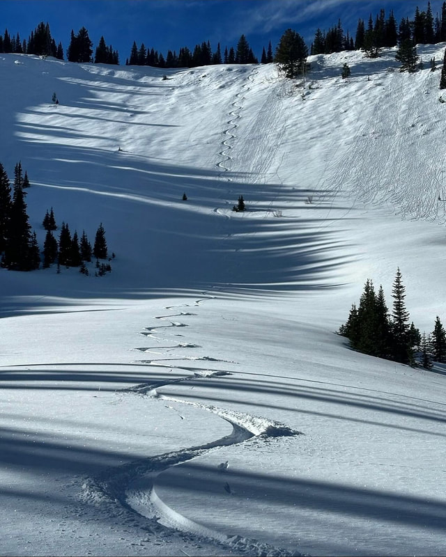
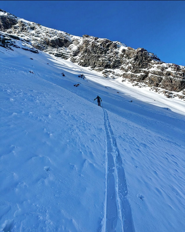
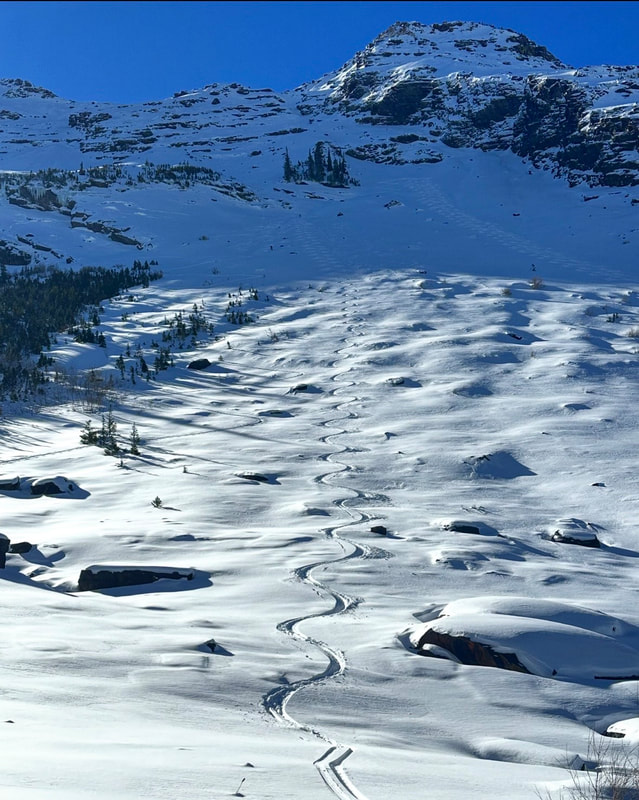
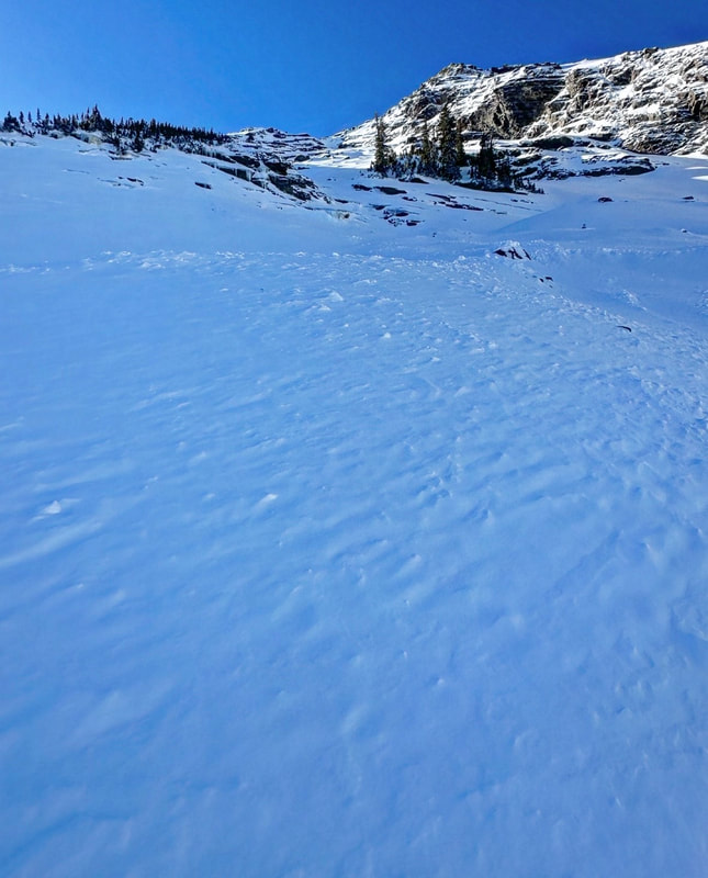
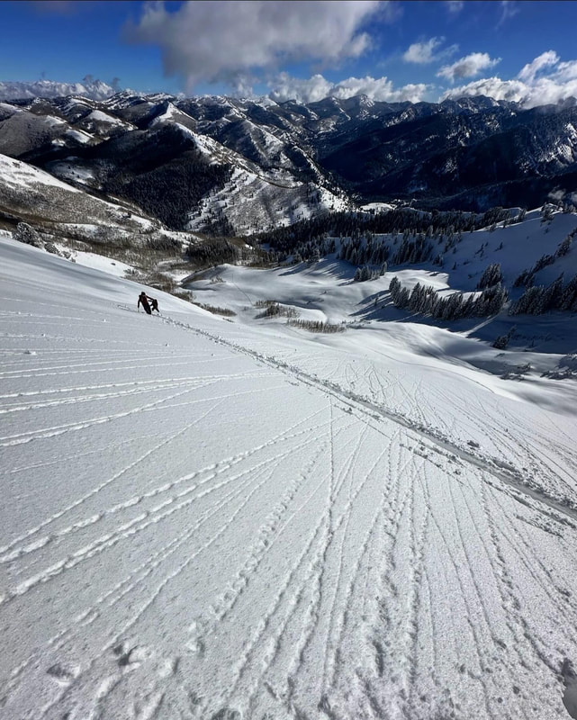
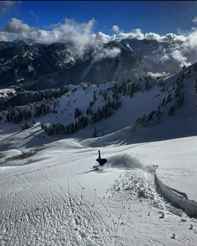
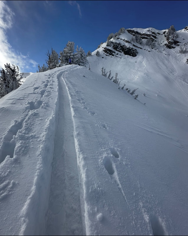
Today I went up Butler Fork to have a look at a slide I saw from Wilson Peak the other day. I know this slope well. I was caught in a avalanche on it last year and got shoved into a stand of trees and buried up to my chest. The slope is NE facing and very protected, it has a really steep headwall but the steep part is not super long. Then it rolls out on a low angle apron. As soon as I got to the toe of the slide I realized it was pretty massive. The slide started on the steep E facing portion and also included the SE portion that wraps around at the top. The toe of the slide was way down in a flat meadow at the bottom. I've always wondered how far this path could run and now I know. I’ve looked at a bunch of slides in the last couple weeks but this one stood out. It removed old growth trees on the flanks of the path and flagged trees up to 40ft high removing all the branches on the upslope side. The PWL must have been really bad in this area. The distance the slide traveled on low angle terrain was impressive,up to a third or half a mile. I did travel up to the steep part of the slope and the PWL was not there, just a hard bed surface with a foot of well bonded snow resting on it. Things are still highly suspect in my mind and I will continue to stick to lower angle slopes on the N end of the compass or slopes that avalanched and cleaned out the PWL. If I can’t tell if the PWL has been cleaned out I’m just gonna pass for the time being. The warm temperatures and settlement are definitely helping, but I’m holding my cards tight for now.
0 Comments
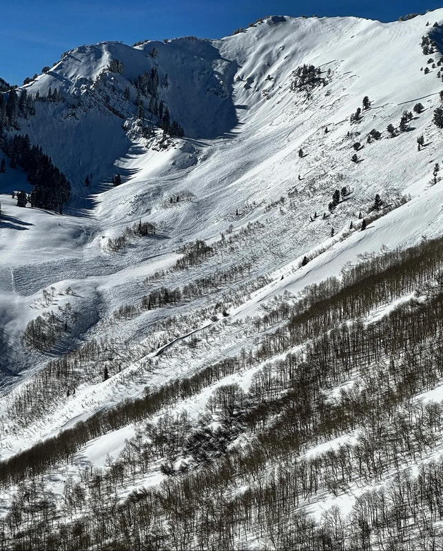
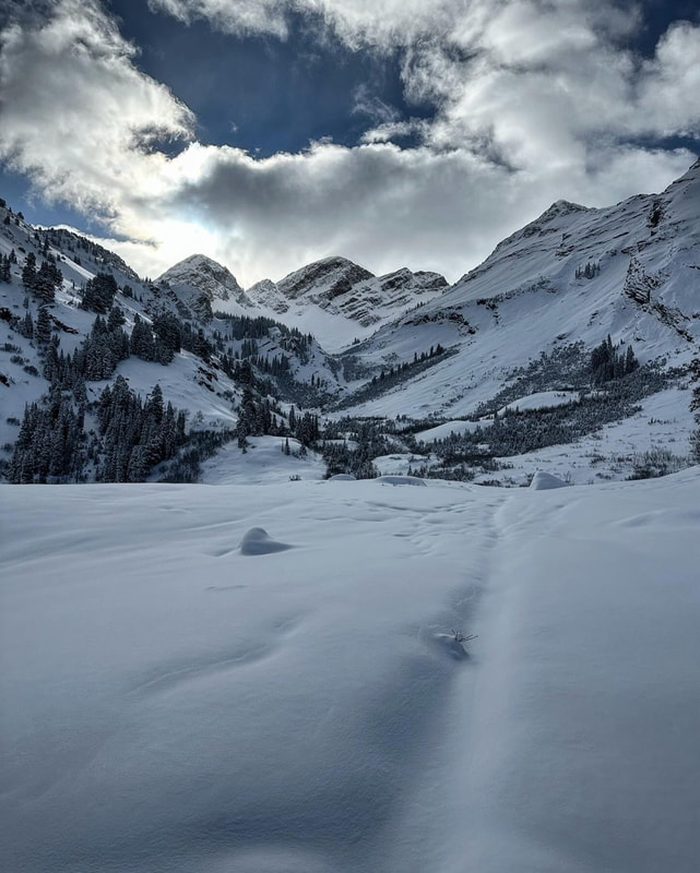
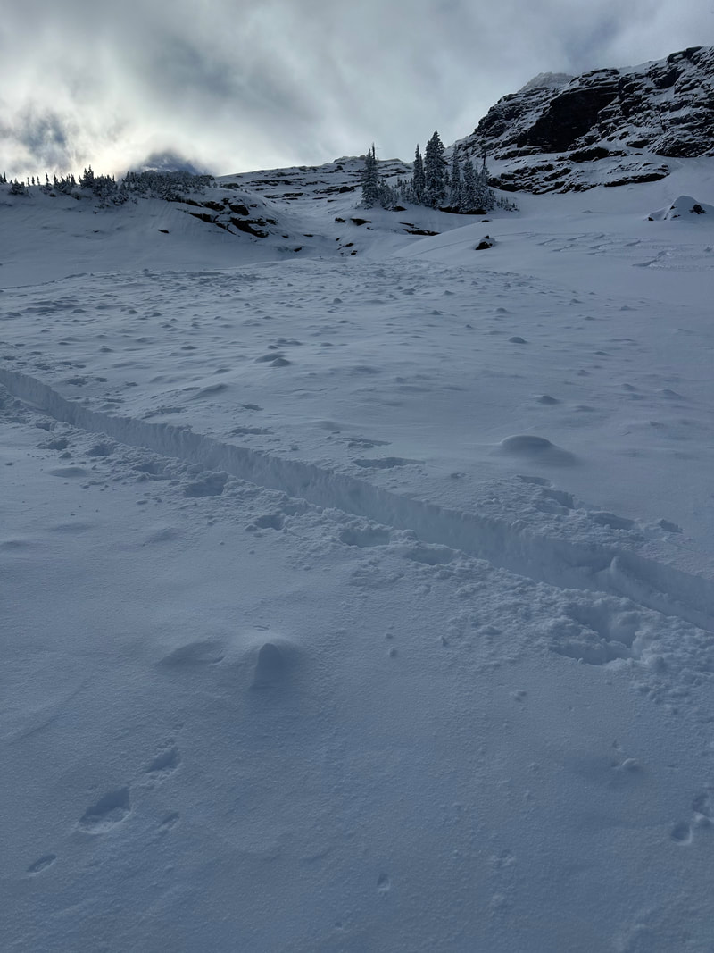
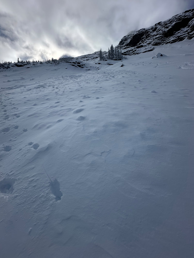
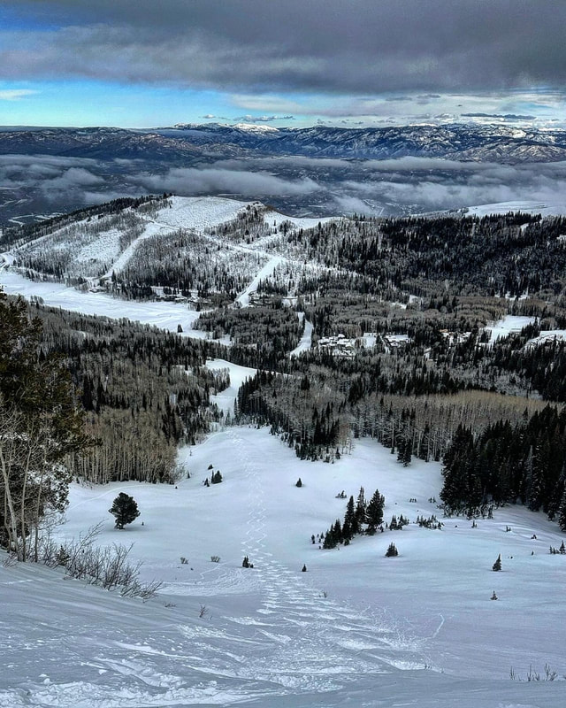
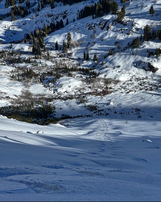
Went to look at avalanches today, specifically the ones in Butler Basin, Wilson and Alexander Basin. We came in from Mill D North because we didn’t want to walk through Scary Gully, a terrain trap that must be crossed if ascending from Butler Fork trailhead. I’m just gonna list the avalanches and aspects because there were so many. Once we got to Dog Lake we noted a large slide on the shoulder of Reynolds Peak which ran on the PWL. Next we traveled on to Soldier Fork where we trigged a large slide on Friday. That slide had filled back in but we did note another slide that started on a 28 degree slope. Once we gained the top of the Nipple we had a panorama of slides to look at. The Wilson Chutes had run wall to wall during the storm with the newer slides on the headwall most likely triggered by cornice falls. Wilson Glade had also avalanched mid slope as usual. The well documented slides in Buttler Basin were also impressive. The big stand out was the SE face of Wilson which avalanched to the ground and ran close to 2500 vertical feet. There where also multiple slides in N facing Butler Basin along with E facing like Swedish Corner and the Honey Hole. We also got a good look into Alexander Basin where there were multiple large slides. Here’s the list, East Chute, Depth Hoar Bowl - wall to wall, Toots Sweet and Toots to Boots had also avalanched. The Toots Sweet one was impressive. I’m not convinced at all that the slides on the polar aspect cleaned out the PWL but the large slides on the SE facing had basically run on the old slippery surface or the ground and do not have the PWL present now. With more snow on tap this week not trusting anything steep yet and waiting to see if the PWL reactivates with more weight.
Soldier Fork Avalanche1/11/2024
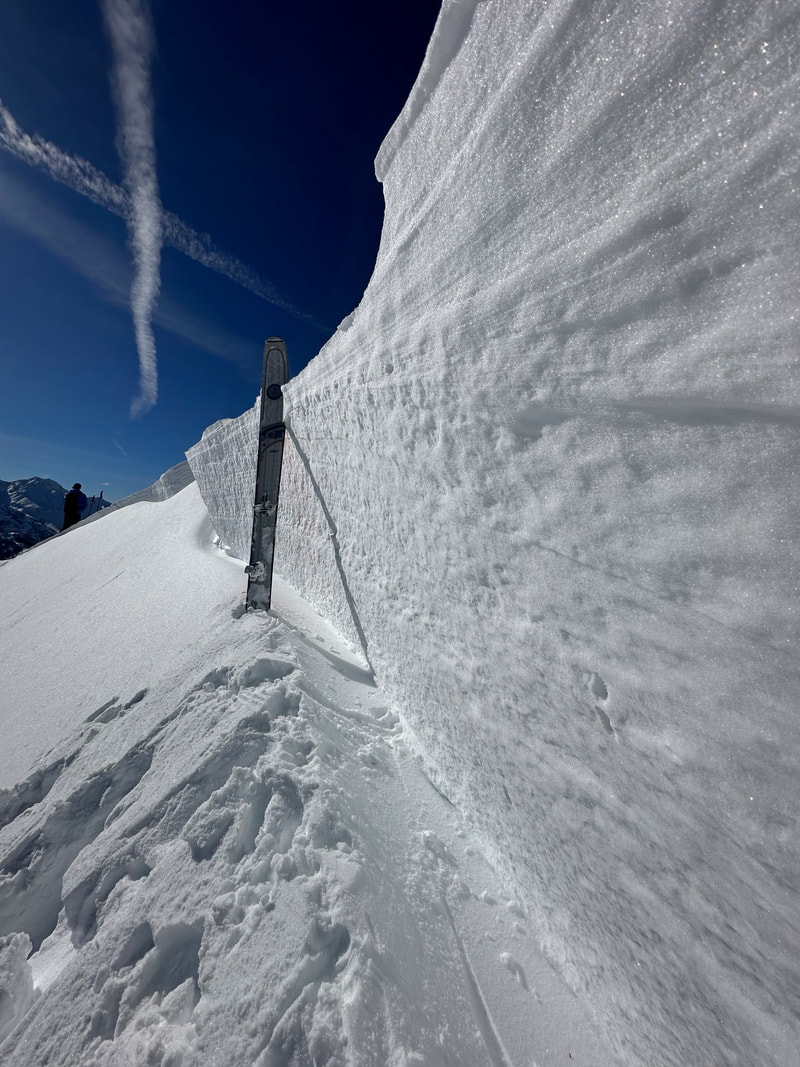
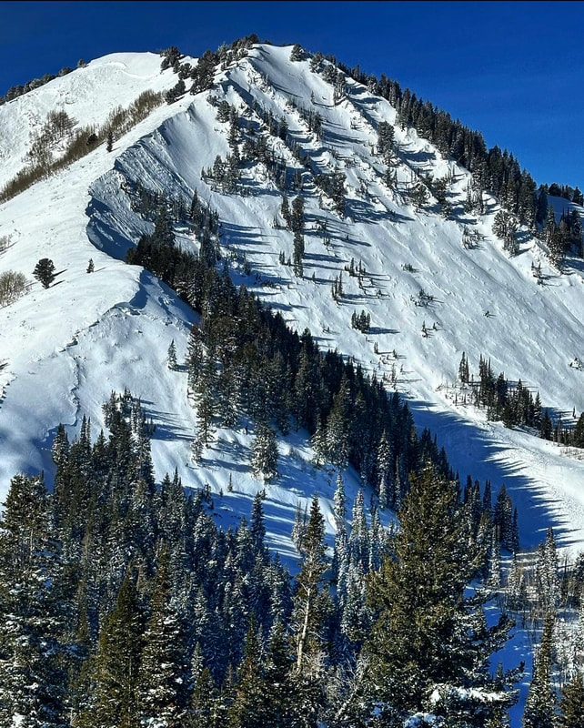
Today we traveled up Mill D North to Dog Lake then on into Butler Fork to Soldiers Fork and the Nipple. Been waiting for the tipping point of the snowpack and found it today. While traveling up the trail to Dog Lake I walked up one of my favorite test slopes in the area, a NE facing slope that is wind protected. A few steps off the main track I was able to get the slope to collapse and shooting cracks appeared. We continued on to Dog Lake where the skin track ended and we started breaking trail into Butler Fork. By the time we reached the base of the Nipple, we had experienced multiple collapses. We started walking up the ridge that separates Soldier Fork and the Nipple. Aout 30ft later we felt a large collapse, watched the bushes around us shake and then saw the whole face of Soldier Fork N facing avalanche wall to wall. The crown was around 600ft wide and 4ft deep at the deepest. The avalanche ran on the PWL formed during the dry spell through most of December. We remotely triggered the slide from over 200ft away from the flat ridge. After inspecting and documenting the avalanche we continued on to the Nipple.
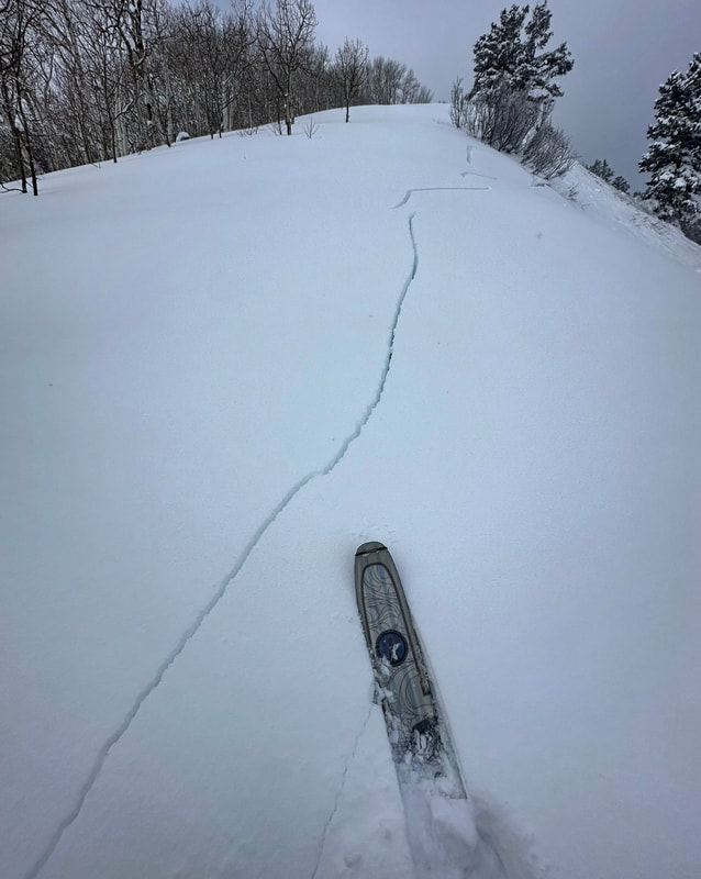
I’ve always been under the impression that this slope never slides due to its low angle. However, about 3 turns in I felt a large collapse and watched shooting cracks propagate under my skis. I hung a hard left into even lower angle terrain but the slope didn’t release. On our next run we took a closer look, the slope had fractured deep, down to the PWL in multiple spots but did not slide due to its low angle. The time has come to back way off, stay away and out from under avalanche terrain and let nature do its thing. I’m pretty sure that we are in for a large natural avalanche cycle if the next few days forecast is on point. Don’t get me wrong, it’s already super sketchy right now, but with more weight everything that is steep enough to avalanche has a good chance of coming unglued naturally. Broads Fork1/8/2024 Today we decided to try to ski up in Broads Fork. Definitely not a place to be if avalanches are on the menu. Our decision was based on light density snow, no slab, and a fairly large avalanche that had already run in the Diving Board. We went up there with the plan to bail if there was any sort of slab development or wind which there wasn’t. The fairly large avalanche that had already run from off the East Twin solidified our plan. There was close to 20 inches of light density snow resting on either facets or windboard depending on location. We constantly probed the snow on the way up and transitioned in the safety of the previous avalanche. All bets will be off with settlement of the pack and the strong prefrontal winds forecasted for tomorrow. It was kinda like getting a hall pass for one more day in avalanche terrain then backing way off when the slab thickens up Bowman, Toots, and Yellowjacket1/6/2024
Today travel was up the Bowman trail in Millcreek, Toots to Boots into Alexander Basin, then on to Yellow Jacket. Not a whole lot to say without sounding like a broken record but things are about to get interesting. The new snow was basically fluff. There was about 8 to 10 inches of new light density snow, with zero wind in the terrain covered. No slab meant we could ski whatever we wanted but with one caveat, Watch Your Sluff! The sluffs were running fast, and gouging down to the dirt in some places leaving large debris piles. We didn’t realize the power of the sluffs until our first run in Toots. My partner skied first and I had to yell to alert him of a large sluff chasing him down the center punch. He let it go by and the size and power was impressive. Once we discovered that sluffs were the main hazard we proceeded to use ski cuts to mitigate them. This is some of the weakest snow I’ve ever seen in the wasatch, and I’ve been around a while. Add some more snow and wind and we have a serious problem. Today you could get away with most things, but if the weather forecast comes through all bets are off and it’s time to watch your ass in all avalanche terrain and runout zones.
PC Ridgeline- before the storm1/4/2024
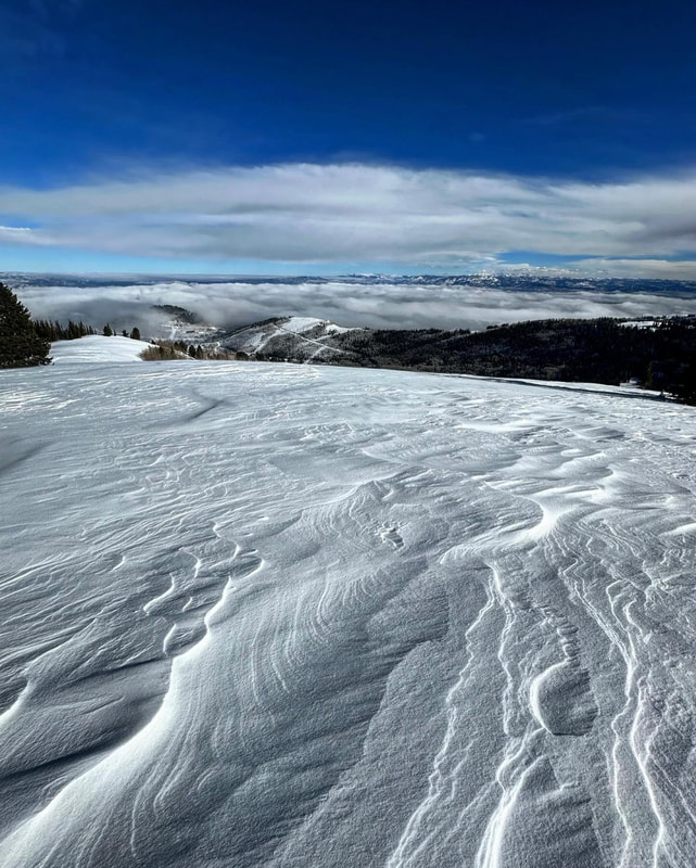
Went out to have one last look at the snow before the meat of the storm arrives. Travel was up to the PC Ridgeline- W Monitor, S Monitor, No Name Bowl and Scott’s Bluff. New snow amounts were in the one to two inch range by mid day. We have multiple problematic layers in our shallow snowpack. The pile of loose well developed facets on the surface and below crust layers has been well documented and exists on most polar aspects. The slopes that avalanched during our large avy cycle almost a month ago now are thin, in the one too two foot range, and many have faceted to the ground lacking any type of cohesion whatsoever. In other terrain the surface snow has faceted down to some fairly stout crusts that will act as a slippery bed surface and create long running slides when we get a load. I also found something unusual for the Wasatch which is buried surface hoar. Usually the prefrontal winds and warm temperatures destroy the surface hoar before it has a chance to get buried, but I found intact surface hoar buried in multiple places today by a inch or two of new snow. We’re just gonna have to wait to see what happens with this layer. If it becomes depth hoar we’re in trouble. But I guess in the long run it doesn’t matter what layer is the culprit. All that really matters is that if we get a decent load of snow or a slab it’s not going to stick to the underlying snow. The foundation of our snowpack is garbage and with a bad foundation avalanches are going to be a problem on steeper slopes for some time to come. The video is loose facets on the surface and the buried surface hoar I found.
No Name Bowl12/13/2023 Todays' travel was to No Name Bowl on the PC Ridgeline. The wind was blasting from the E most of last night and all day today. I figured NoName might still be good seeing that it sits at mid- elevation and is somewhat protected from the E winds by the topography. All the other slopes at higher elevations were completely windjacked or wind loaded depending on aspect. On the walk up I encountered every snow type- sun-crust, wind crust, ice, wet snow, and wind slab. When I rolled off the knob into NoName I was pleasantly surprised with the texture of the snow. I knew most of the slope had avalanched during last weeks cycle and stuck to a line that stayed within the boundary’s of the slide. I’m pretty cautious when I'm traveling solo. So I first stepped down into the bowl and probed the snow. I found about a foot and a half of settled powder on dirt. Then I made a few turns and checked again. Same deal, so I skied the line a few times. I stayed away from the part of the bowl that did not slide. By the time I was leaving the wind was doing its thing to the upper portions of the bowl and probably will not be as user friendly tomorrow. I would think the high E winds probably loaded W facing slopes in the upper alpine and might begin to overload some slopes that didn’t go last week. Broads Fork12/12/2023 Went up Broads Fork for a look around. Not much snow at the trail head at 6000ft but close to 3 feet at 9000ft. We went up hoping some of the big slopes like the Diving Board and Bonkers had avalanched during the big cycle last week and would allow safe passage. Luckily both slopes had evidence of having under went large avalanches. I doubt we would have ascended if they hadn’t already slid. We went to the Diving Board because we saw a large avalanche right in the middle where it usually slides. Once we got to the base of the slope we realized an older slide had occurred earlier and avalanched out the whole slope. Constantly probing on the way up, it became apparent that the whole slope had been impacted by multiple large slides from off of the Twins and the upper Blue Ice. We put all this information together and decided there was not much hazard above us, which is a real thing in Broads, and that the old faceted snow had been mostly destroyed by the large avalanches. I always put a lot of thought into where I’m going and there is a method to the madness. We could definitely use some more snow. Still lots of rocks and bushes in the lower canyon drainages, and the exit requires walking out, at least for us it did. In my opinion, the next thing we’re going to have to deal with is faceting of the surface snow if we have an extended dry spell. This includes faceting of the whole snowpack in places where the pack is not deep. Powder fun!12/10/2023
Just throwing up some fun. This is quite a crew- from Pete's 22 year old kid to Rad Brad the Hippy and everything in between. Skiing powder knows no bounds. Make America Eight Again.
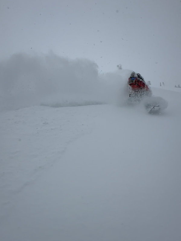
Cardiff (12/8) and Butler (12/9)12/10/2023 We had a few warm days leading up to the most recent storm on 12/7-8. The storm came in warm and laid down a layer of graupel and denser snow coupled with fairly strong winds. Then on 12-8 the lake effect kicked in and delivered another couple feet of light density blower, with moderate wind speeds. The two days of warm weather before the storm crusted up the surface of the snow below 8500ft on most aspects, then locked it up when it got cold. It seemed like a good portion of the high elevation steep slopes that had the PWL had avalanched before this most recent storm. Fridays travel was up Cardiff Fork from the BCC side. We ended up in Ivory Flakes knowing that the over head hazard had recently avalanched fairly large and there was not a slab sitting on weaker snow. High PI rates up to 3 inches a hour kept us away from anything steep. Visibility was hard to come by, but the only activity noted was sluffing in the new snow and some pockets of wind loaded snow. The next day we woke up to sunny skies, light winds and cold temperatures. Not knowing exactly how the new snow was bonding, or if the new load was enough to trigger slides down to the PWL we decided to ski steep S facing terrain in Butler Basin. All the N and E aspects had avalanched impressively the previous week. The bed surface on the S facing was basically a frozen, consolidated brick sitting on dirt, and we discovered that the bond with the new snow was good. We skied steep S with zero activity off the back side of Gobbler’s Knob. The surface did end up getting damp and there was some damp snow and crusts on the S on sunday. Between the widespread avalanche cycle last week and a couple days of unusually warm weather it seemed to consolidate the snowpack and start the healing process on the slopes with old faceted snow. We’re not out of the woods yet with the PWL (in my opinion) seeing that a few slides like the one in the Wilson chutes are still being triggered remotely. Avalanches are becoming much harder to trigger and the slopes with the most snow at higher elevations seem to becoming more stable. I’m still wary of steep slopes on the N end of the compass in thinner snowpack areas outside the upper Cottonwood Canyons. Especially rocky slopes where a slide could be triggered in a thin spot in the overlying slab. On the bright side, the last few storms have opened up a bunch of new terrain, and the deeper the snow pack gets the more stable it becomes. Photos are from Ivory Flakes during the storm and Butler Basin after the storm. If you are enjoying the observations, please consider donating on VenmoMark-White-240 
Archives
January 2024
Categories |

 RSS Feed
